
✅ Quick Answer
Skip the reading and check current pricing:
🎁 Holiday shopping for a Jeep owner? See our 2026 gift guide for Jeep owners and overlanders — picks from $35 stocking stuffers to rooftop tents.
Updated May 2026 — pricing and features verified for all five apps.
TL;DR — At a Glance
| Best For | App | Why | Price |
|---|---|---|---|
| Best overall (overlanding standard) | Gaia GPS Premium | Best map layer selection in the industry. USFS, BLM, topo, satellite, cell coverage maps. The app most overlanders run. | ~$59.90/yr |
| Best trail database + easiest UI | onX Offroad Elite | 650,000+ miles of off-road trails, land ownership overlays, vehicle-specific filters, CarPlay/Android Auto support. Fastest learning curve. | ~$99.99/yr |
| Best bundle value | Outside+ | Gaia GPS Premium + Trailforks Pro + Outside content in one subscription. If you want both apps, this is the play. | ~$89.99/yr |
| Best for campsite finding | The Dyrt Pro | 1M+ campground reviews, offline maps, dispersed camping layers, alerts for sold-out sites. Pairs with any nav app. | ~$59.99/yr |
| Best for multi-sport + desktop route planning | Trailforks Pro | 800,000+ trails with drag-and-drop desktop route builder. The best planning tool for overlanders who also mountain bike or hike. | ~$40.49/yr |
Why Your Phone’s Maps Will Fail You Out There
Google Maps and Apple Maps are built for pavement. The moment you turn off the highway onto a Forest Service road in the San Rafael Swell, point your Jeep toward the White Rim Trail in Canyonlands, or start threading through BLM land on the Arizona Strip, you’ve left their data coverage behind.
Utah specifically is one of the most complex states in the country for land access. About 65% of Utah’s land is federally managed — split between BLM, USFS, NPS, and state trust lands — each with different rules about dispersed camping, fire restrictions, motorized access, and seasonal closures. The same canyon mouth can be open BLM land on one side and closed wilderness or private land 200 yards later. Without the right map layers, you’re guessing.
The apps below aren’t just navigation tools. They’re offline maps, land ownership databases, trail condition platforms, campsite finders, and route planners — sometimes all at once. Here’s how they break down.
Why You Should Trust This Post
I’ve been overlanding in a 2018 Jeep Wrangler JK for six years, spending most of that time in Utah’s canyon country — the Moab area, the San Rafael Swell, the Uintas, and the backcountry around Escalante. I’ve used onX across three of their platforms (Hunt, Backcountry, and Offroad), and I’ve used Trailforks extensively for desktop route planning on mountain bike trips throughout Utah and southern Colorado.

Gaia GPS is what most serious overlanders in my community run — it’s earned its reputation, and I’ll explain exactly why. The Dyrt and Outside+ are picks I’ve added for good reason: campsite data and bundle value matter when you’re planning multi-day trips into areas with no cell service.
FTC disclosure: Some links in this post are affiliate links. I earn a small commission at no additional cost to you if you purchase through them. I only recommend apps I’ve personally used or that come highly recommended by the overlanding community.
The 5 Best GPS Apps for Overlanding
1. Gaia GPS — The Overlanding Standard
If you ask ten experienced overlanders what app they run, at least seven will say Gaia GPS. It has become the de facto standard in the community — not because of marketing, but because it does the one thing overlanders need most better than anything else: map layers.
Gaia’s strength is how many map sources you can stack and toggle. On a single screen you can layer USFS Motor Vehicle Use Maps (MVUM) to see legal motorized routes, BLM surface management layers to identify public land, topo maps for terrain reading, high-res satellite imagery, and cell coverage maps that show estimated coverage by carrier (AT&T, Verizon, T-Mobile). No other app gives you this combination out of the box.
For Utah specifically, the MVUM and BLM layers are essential. They answer the two questions that get overlanders in trouble: “Am I on a legal motorized route?” and “Is this public or private land?” Those questions come up constantly in the San Rafael Swell, around the Bears Ears monument, and anywhere you’re threading through mixed BLM/private country.
Gaia’s route-building tools are powerful but have a steeper learning curve than onX Offroad. You’re building routes from scratch on a map, not selecting from a pre-built trail database. That’s actually a feature if you’re the type who wants to plan your own line — but if you want to pick from community-reviewed routes, onX is easier.
Pricing:
- Free: Basic maps, GPS tracking, limited offline areas
- Premium (~$59.90/yr): Full map layer access, unlimited offline maps, advanced route tools, weather layers, wildfire tracking
- Premium with Outside+ (~$89.99/yr): Premium + Trailforks Pro + Outside content (see Outside+ section below)
Pros: Best map layer selection of any overlanding app. USFS, BLM, and MVUM layers are best-in-class. Cell coverage maps are genuinely useful for trip planning. Extremely customizable for power users.
Cons: Steeper learning curve than onX. No pre-built trail database to browse. Route-building from scratch requires more time than selecting from onX’s catalog.
Best for: Experienced overlanders who want full control over map layers and route building. Anyone spending significant time on BLM or USFS land in Utah.
2. onX Offroad — The Easiest Trail Database
→ Try onX Offroad (7-day free trial)
I’ve used onX on three different platforms — Hunt for deer and elk seasons in the Wasatch, Backcountry for ski touring, and Offroad for vehicle-based exploration. The brand’s core strength is the same across all three: land ownership data and a clean interface.
onX Offroad’s trail database is massive — 650,000+ miles of off-road trails across the US — and critically, it includes vehicle-specific filtering. You can filter trails by 4×4, ATV/UTV, overland, dirt bike, or SxS, and get trails suited to your rig. Community descriptions, photos, and ratings are attached to most popular routes. For someone new to overlanding who wants to explore Moab’s Fins and Things, Hell’s Revenge, or the White Rim Road without the homework, onX Offroad is the fastest path to a vetted route.
The Elite tier adds what I consider the most important feature for Utah overlanding: private land ownership boundaries. You see exactly where public land ends and private land begins, with landowner names. In a state as patchwork as Utah — where BLM parcels are surrounded by state trust land, private ranches, and tribal land — this is critical for both legal access and for planning where you can camp.
onX Offroad also supports CarPlay and Android Auto, which is genuinely useful when you have your phone mounted on the dash — turn-by-turn navigation on your screen without touching your phone.
Pricing:
- Premium (~$34.99/yr): 650k+ trail database, offline maps, tracker, recreation points
- Elite (~$99.99/yr or $14.99/mo): Everything in Premium plus private land boundaries, landowner info, bi-weekly aerial imagery updates, pro gear discounts
Both start with a 7-day free trial.
Pros: Best trail database in the category. Vehicle-specific filtering. Land ownership overlays at Elite tier. CarPlay/Android Auto support. Fastest learning curve — intuitive UI from day one. Motorized dispersed camping layer on USFS lands.
Cons: Elite is the most expensive single-app subscription on this list at $99.99/yr. Map layer selection not as deep as Gaia for power users. Best value is clearly Elite — Premium feels underpowered by comparison.
Best for: Overlanders who want a plug-and-play experience with a large trail database. New overlanders who don’t want to build routes from scratch. Anyone who values land ownership data and a clean UI over deep map customization.
3. Trailforks — Best for Multi-Sport Route Planning
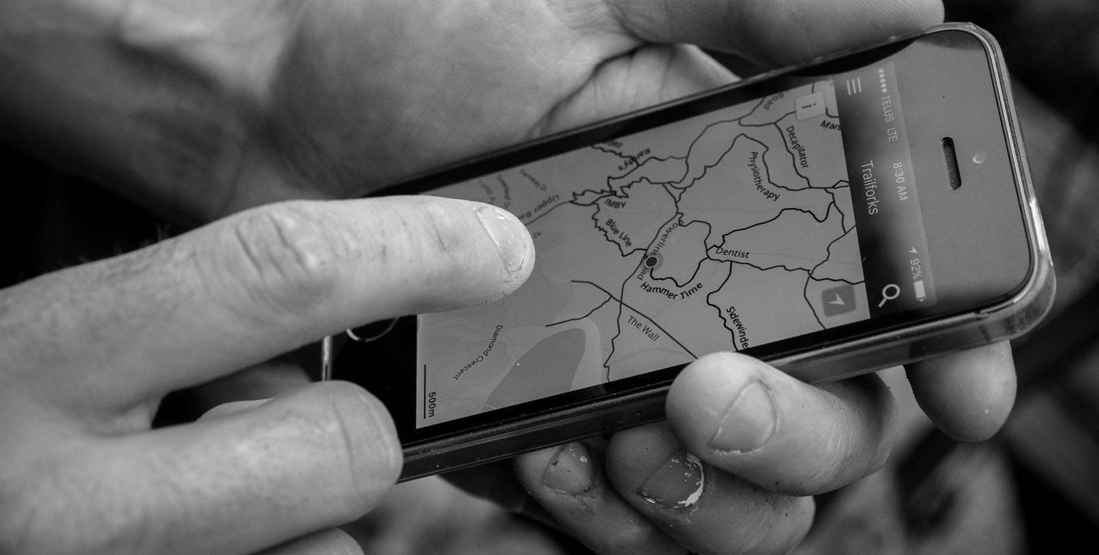
Trailforks started as a mountain bike trail database, and it’s still the dominant platform for that — but for overlanders who combine vehicle travel with riding, hiking, or other non-motorized adventures, it fills a gap the other apps don’t.
I’ve used Trailforks extensively for desktop route planning on mountain bike trips in Utah — Moab’s Whole Enchilada, the Gooseberry Mesa trails near Hurricane, the Wasatch Crest Trail — and it’s the best desktop planning tool available for this. The drag-and-drop route builder on the web platform lets you construct a ride, see elevation profiles, identify trail direction and difficulty, and save it to your phone before you leave. No other trail app has this desktop experience.
For overlanding, Trailforks is most useful as a secondary app: you use Gaia or onX for vehicle navigation and use Trailforks to find and plan the hikes, rides, or day trips you’ll do from camp. It covers 800,000+ trails across 100+ countries, with metadata like difficulty, surface type, direction, and seasonal status on most established trails.
The value inflection point for Trailforks is the Outside+ bundle (see below). At $40.49/yr standalone, it’s priced well. But at $89.99/yr bundled with Gaia GPS Premium through Outside+, it becomes the obvious choice if you want both apps.
Pricing:
- Free (local area only): 14-day trial with full access, then restricted to your local region
- Pro (~$40.49/yr): Full worldwide trail access, offline maps, route planning, Strava segments
- Pro with Outside+ (~$67.49/yr): Trailforks Pro + Outside content (without Gaia GPS)
Pros: Best desktop route planning of any trail app. 800,000+ trails, 100+ countries. Strong community data with current trail conditions. Integrates with Gaia GPS map layers directly. Built-in Strava segment overlay.
Cons: Not a dedicated overlanding/navigation app — you’ll still need Gaia or onX for vehicle navigation. Mobile app is not as polished as Gaia or onX for real-time navigation.
Best for: Overlanders who also mountain bike, hike, or trail run and want one app that covers all non-motorized trail planning. Anyone who does trip planning on a computer before heading out.
4. The Dyrt Pro — The Campsite Layer You’re Missing
→ Try The Dyrt Pro (30-day free trial)
The Dyrt is different from the other four apps here — it’s not a navigation or route-planning tool. It’s the most comprehensive campsite database available, and it fills a specific gap that every serious overlander eventually hits: finding and planning where to actually sleep.
With 1 million+ user-submitted reviews, The Dyrt covers RV parks, state parks, national parks, dispersed camping areas, free overnight parking, and more. The Pro tier adds offline maps and — critically — a free camping layer that shows 16,000+ dispersed and overnight parking locations across public land. In Utah, where BLM dispersed camping is abundant if you know where to look, this layer is a genuine trip-planning asset.
The Dyrt Pro also includes a sold-out campground alert system (Dyrt Alerts) that notifies you when a full campground opens up — useful for popular spots like Arches or Zion where reservations are competitive. Up to 40% off campground fees at participating sites is included with Pro as well.
Think of The Dyrt as your campsite intelligence layer — run it alongside Gaia or onX rather than instead of them. It answers “where can I sleep tonight?” while the navigation apps answer “how do I get there?”
Pricing:
- Free: Basic campground search, user reviews
- Pro (~$59.99/yr): Offline maps, free camping layer, Dyrt Alerts, campground discounts, RV trip planner, 30-day free trial
Pros: Largest campsite database available. Free camping and dispersed camping layers are genuinely useful. 30-day free trial is the most generous on this list. Campground discount partnerships offset the subscription cost. Excellent offline capability.
Cons: Not a navigation app — you need Gaia or onX alongside it. Free camping data quality varies by region (Utah coverage is generally strong; some rural areas are sparse).
Best for: Any overlander who wants help finding dispersed camping and boondocking spots. Road-trippers who move frequently and need campsite data across multiple states. Pairs with any navigation app.
5. Outside+ — The Bundle That Changes the Math
Outside+ isn’t an app — it’s a subscription bundle that changes what Gaia GPS and Trailforks cost.
Here’s the math: Gaia GPS Premium is $59.90/yr. Trailforks Pro is $40.49/yr. Together, that’s $100.39/yr if you buy them separately. Outside+ is $89.99/yr and includes both apps — plus unlimited access to Outside magazine, Velo, Pinkbike, Outside TV, training plans, gear guides, and exclusive deals.
Outside+ is actually $10.40 cheaper than buying Gaia and Trailforks separately — and throws in the full Outside media library on top of it. If you want both apps, this is a no-brainer.
The bundle works seamlessly: you sign up for Outside+, connect your Gaia GPS account, and your Gaia Premium access activates. Same for Trailforks. Both apps recognize your Outside+ subscription through their respective logins.
Pricing:
- Outside+ (~$89.99/yr): Gaia GPS Premium + Trailforks Pro + Outside content library
Pros: Best per-dollar value if you want both Gaia and Trailforks. Adds a large content library at minimal cost over buying apps separately. Single subscription manages both app access.
Cons: Doesn’t include onX Offroad or The Dyrt — you’ll still need separate subscriptions for those. Outside media library won’t interest everyone (but it’s essentially free if you’re buying both apps anyway).
Best for: Anyone who wants both Gaia GPS and Trailforks. Multi-sport overlanders who mountain bike or hike. Anyone who reads outdoor media.
Which App Is Right for You?
If you want one app and want to get out the door fast: Start with onX Offroad Elite. The trail database is massive, the UI is intuitive, and land ownership overlays mean you won’t accidentally camp where you shouldn’t.
If you want the most powerful mapping tool and don’t mind a learning curve: Gaia GPS Premium is what most experienced overlanders end up running long-term. The map layer system is unmatched.
If you want Gaia GPS AND do any mountain biking or trail running: Skip buying them separately and go straight to Outside+. At $89.99/yr it’s actually $10.40 cheaper than buying Gaia and Trailforks separately — and includes the full Outside media library.
If you do multi-night trips and struggle to find campsites: Add The Dyrt Pro alongside your navigation app. It’s the only app with a dedicated dispersed camping database and sold-out campsite alerts.
If you already use onX Hunt or onX Backcountry: The brand’s quality and interface carry directly over to Offroad. You already know how it works — just add the Offroad subscription.
Best Overlanding App by Task
Different jobs, different winners. Here’s the quick answer for the questions overlanders ask most:
Best for turn-by-turn off-road navigation: onX Offroad
onX Offroad’s onX Navigation gives voice-guided, turn-by-turn directions from pavement to the trailhead or a dropped waypoint, works offline once your maps are downloaded, and runs on Apple CarPlay and Android Auto. Gaia GPS also offers turn-by-turn directions, but onX is the easier in-vehicle experience.
Best for planning your own routes: Gaia GPS
Gaia GPS is still the strongest route builder, especially on its web map at a computer. If you like to draw a multi-day route across forest roads, check it against several map layers, and then sync it to your phone, Gaia is the tool.
Best for finding dispersed campsites: onX Offroad + The Dyrt
onX Offroad Premium includes dispersed camping maps showing where camping on public land is allowed. The Dyrt Pro adds a database of user-reported dispersed sites and campground reviews. Together they cover both “where am I allowed to camp” and “where have other people actually camped.”
Best for finding trails by vehicle and difficulty: onX Offroad
onX lets you filter trails by vehicle type (4×4, SxS, ATV, dirt bike) and shows open/closed status and recent trail reports, so you can pick a trail that suits a stock or built Wrangler.
Best off-road GPS app for Android
All five apps on this list run on Android. onX Offroad is the best fit for Android drivers who want in-dash navigation because it supports Android Auto; Gaia GPS is the pick for Android users who plan routes on a computer first.
Best free option
Both onX Offroad and Gaia GPS have free versions with basic maps and tracking, but free tiers limit offline maps — onX’s free version saves just one offline map. For real backcountry trips, the paid tier is worth it: onX Offroad Premium is $34.99/year.
Full Comparison Table
| App | Best For | Offline Maps | Land Ownership | Trail Database | Price/yr | Free Trial |
|---|---|---|---|---|---|---|
| Gaia GPS | Map layers, BLM/USFS access, power users | ✅ Unlimited | ✅ (Premium) | Custom routes | $59.90 | Limited free tier |
| onX Offroad | Trail discovery, ease of use, land boundaries | ✅ Unlimited | ✅ (Elite only) | 650,000+ mi | $34.99–$99.99 | 7 days |
| Trailforks | MTB/hiking, desktop route planning | ✅ (Pro) | ❌ | 800,000+ mi | $40.49 | 14 days full access |
| The Dyrt Pro | Campsite finding, dispersed camping | ✅ (Pro) | ❌ | Campsites only | $59.99 | 30 days |
| Outside+ | Best value bundle (Gaia + Trailforks) | ✅ (via Gaia) | ✅ (via Gaia) | Both apps | $89.99 | Varies |
Frequently Asked Questions
What is the best off-road navigation app?
For in-vehicle, turn-by-turn off-road navigation, onX Offroad is the best overall: it has voice-guided onX Navigation, works offline, and supports Apple CarPlay and Android Auto. Gaia GPS is best for building your own routes.
Which overlanding app has turn-by-turn navigation?
onX Offroad (onX Navigation) and Gaia GPS both offer turn-by-turn directions. onX Offroad adds Apple CarPlay and Android Auto support, making it easier to use on a Jeep’s screen.
What app shows dispersed camping?
onX Offroad Premium includes dispersed camping maps that show where camping is allowed on public land. The Dyrt Pro adds user-reported dispersed campsites and reviews.
Do I need cell service for these apps to work?
No — that’s the whole point. Every app on this list supports offline maps downloaded in advance. The workflow is: plan your trip at home on WiFi, download the map area you’ll be in, then navigate offline when you’re in the field. Cell service is not required once your offline maps are loaded. This is critical in Utah, where cell dead zones are the norm rather than the exception on most backcountry routes.
Is Gaia GPS better than onX Offroad?
They’re best at different things, which is why experienced overlanders sometimes run both. Gaia GPS has deeper map layer customization — particularly USFS MVUM, BLM management layers, and cell coverage maps. onX Offroad has a larger pre-built trail database, more intuitive UI, and better vehicle-specific filtering. If you’re building custom routes and want maximum map data, Gaia wins. If you want to find a community-reviewed trail fast and start driving, onX wins. For most people, Gaia GPS Premium is the better long-term choice because the map layers are genuinely better for land-access decision making.
What’s the best free overlanding GPS app?
Gaia GPS’s free tier gives you basic maps and GPS tracking. onX Offroad offers a 7-day free trial with full Elite access. Trailforks gives 14 days of full access before restricting to your local area. These trials are genuinely useful for evaluating before committing. Long-term, free apps don’t support the offline mapping and land-access features that make backcountry overlanding safe and legal — a paid subscription on at least one app is worth the cost of a single tank of gas per year.
Can I use Trailforks for overlanding, not just mountain biking?
Yes, with caveats. Trailforks covers non-motorized trails primarily — hiking, mountain biking, trail running. It’s not designed for vehicle navigation. Where it shines for overlanders is desktop route planning for the day hikes and rides you’ll do from camp. If you’re overlanding to ride, it’s an essential add-on to your navigation app. If you’re purely in a vehicle the whole time, you may not need it — Gaia or onX will cover you.
Does The Dyrt work in Utah specifically?
Yes — and Utah is one of the stronger states in The Dyrt’s database. The free camping layer covers a significant portion of Utah’s BLM land, including the San Rafael Swell corridor, the area around Capitol Reef, the Arizona Strip north of the Grand Canyon, and dispersed areas near Moab. The user review density is also high in Utah because it’s a heavily traveled overlanding and camping state. The Dyrt Pro’s 30-day free trial is worth running just to evaluate the coverage for your specific area before committing.
What’s the difference between onX Hunt, Backcountry, and Offroad?
Same core technology, same land ownership data, different trail databases and use-case tuning. Hunt is for hunters — game management units, public land access for hunting, harvest reporting data. Backcountry is for skiers, climbers, and hikers — avalanche forecasts, slope angle layers, backcountry ski routes. Offroad is for vehicle-based exploration — OHV trails, vehicle filters, motorized dispersed camping layers. Each is a separate subscription, but if you’ve used one, the interface transfers immediately to the others.
Is Outside+ worth it if I just want Gaia GPS?
If you also want Trailforks, yes — absolutely. Outside+ is $89.99/yr vs. Gaia GPS Premium at $59.90/yr standalone. Buying both apps separately would cost $100.39/yr, so Outside+ actually saves you $10.40 while adding the Outside content library. If you purely want Gaia and nothing else, buy Gaia GPS Premium directly and save $30.
My Final Recommendation
If you’re setting up your phone for overlanding and you want to do it once and do it right:
The core setup for most overlanders: Gaia GPS Premium + The Dyrt Pro. Gaia handles navigation and land-access decisions. The Dyrt handles campsite finding. Together they cover the two most important questions on any overland trip. Total cost: ~$120/yr.
If you also mountain bike or hike: Replace the standalone Gaia subscription with Outside+ and you get Gaia + Trailforks for $89.99/yr. Add The Dyrt and you have the full stack for ~$150/yr.
If you’re new to overlanding and want the easiest experience: Start with onX Offroad Elite. The trail database and clean UI will get you moving immediately. Many experienced overlanders eventually add Gaia, but onX Elite is the fastest path from “I want to overland” to “I’m out there overlanding.”
Whatever combination you choose, the most important thing is loading offline maps before you leave cell service. Every app on this list supports it. Build that habit on trip one, and you won’t get lost on trip two.
FTC Disclosure: This post contains affiliate links. If you buy through them, UT Overland earns a small commission at no additional cost to you. We only recommend apps and gear we’d use ourselves. Thanks for supporting the site.
Related deep-dives: For the head-to-head OnX vs Gaia comparison, see our dedicated OnX Offroad vs Gaia GPS post. Confused about which OnX product to buy? Our OnX Offroad vs OnX Hunt vs OnX Backcountry breakdown explains what each app is designed for.
Related Overland Gear Guides
A GPS app is only one piece of your overland kit. If you’re building out a Jeep Wrangler for backcountry travel, here are the companion guides most readers pair with this post:
- Best Jeep Wrangler JK Roof Rack (2026) — the platform every other piece of gear bolts to.
- Best Rooftop Tents for Jeep Wrangler — 17 tents compared across hardshell, hybrid, and softshell categories.
- Best Awning for Jeep Wrangler — 14 awning brands ranked, plus our 270° vs 180° comparison.
- Best Recovery Gear for Jeep Wrangler — the boards, ropes, shovels, and winches that get you unstuck when the GPS route ends unexpectedly.
Not building a rig? Rent one instead.
If you want the overland experience but don’t want to own a built-out Wrangler, Moterra Campervans rents luxury 4x4 Mercedes Sprinter vans out of 7 hubs across the U.S. — including Jackson (Grand Teton/Yellowstone), Whitefish (Glacier), SLC and Las Vegas (Utah’s Mighty 5), San Francisco (Yosemite), Seattle (Olympic/Rainier), and Portland ME (Acadia). Everything included: kitchen, heater, solar, pet-friendly. See our full Moterra review for the breakdown.