ROAM THE UNKNOWN

Built for every part of the journey, Overlander is the rugged, all-terrain navigator with on- and off-road navigation.

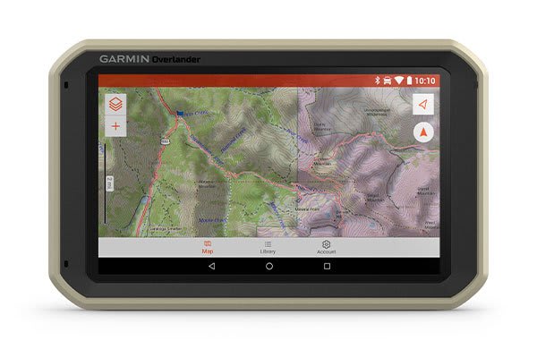
Get the lay of the land with topographic maps for North and South America.

Or get spoken directions to the nearest coffee shop with street maps for North and South America.

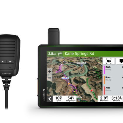
Share1 the plans for adventure through Garmin Explore. From your laptop to your phone to your friends.

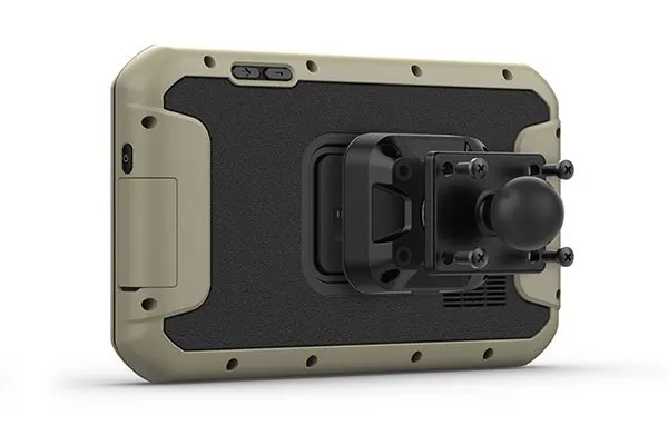
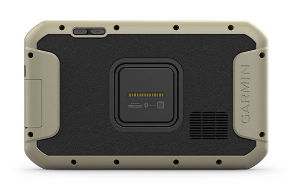
Comes with a powered magnetic mount and an adapter with AMPS plate compatible with RAM mounts. It’s not going anywhere.

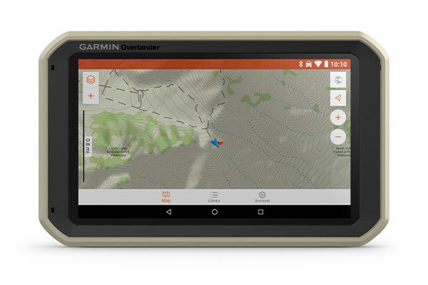
Search for the nearest inspiration point while you’re in the middle of nowhere.

Need to bring your own satellite imagery? How does 64 GB of built-in storage sound?

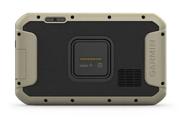
Built tough for the journey ahead.
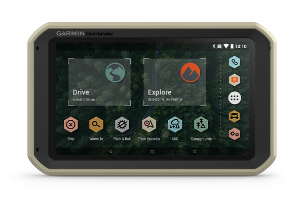
ON AND OFF ROAD

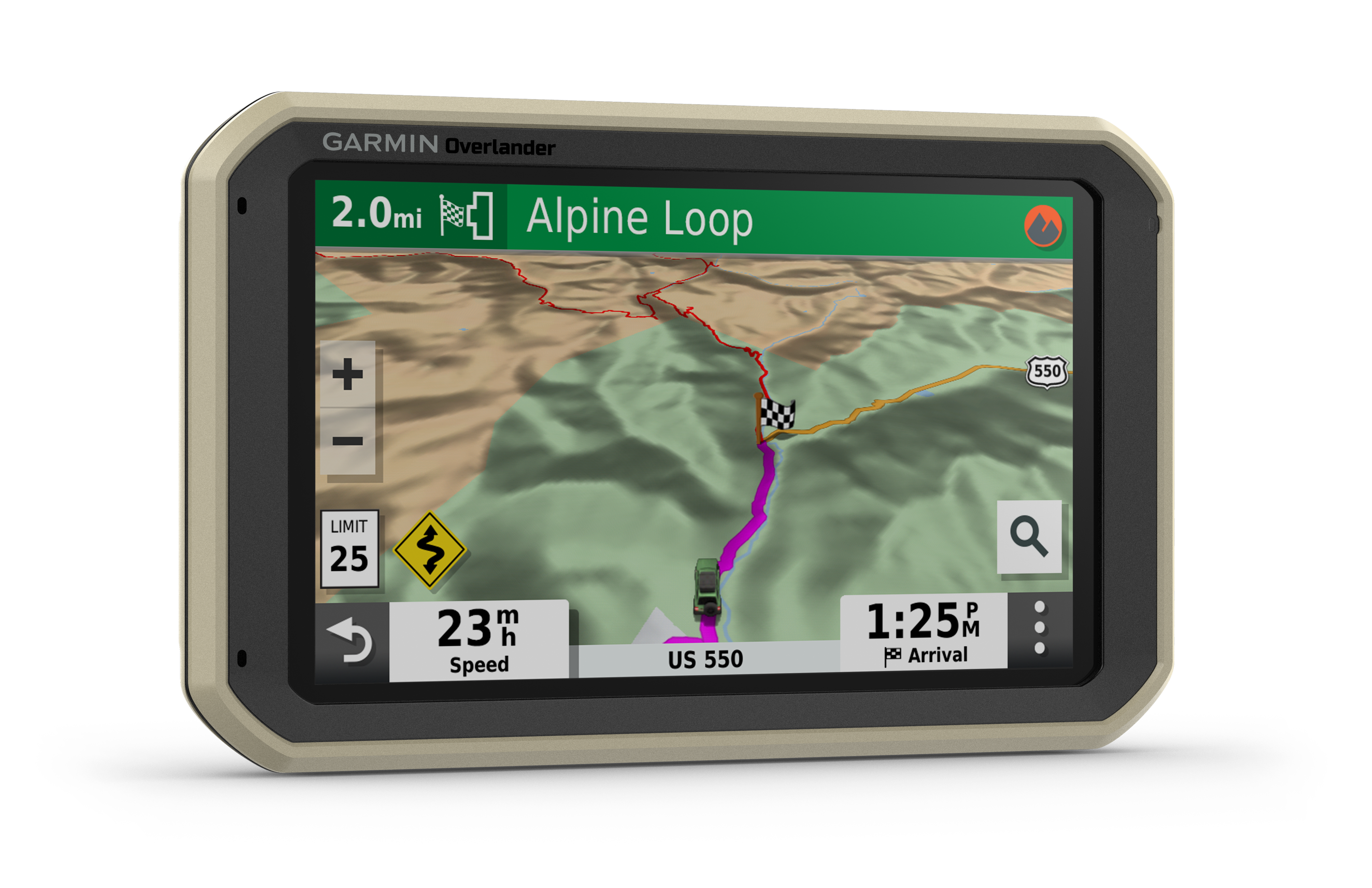
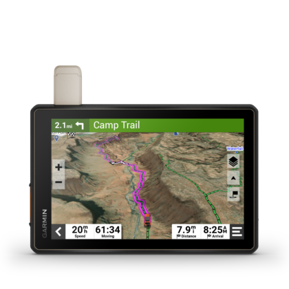
7” color touchscreen features turn-by-turn directions for on-road “turn-by-turn” navigation and topography maps for off-road “point-to-point” guidance in North and South America. Also compatible with HuntView maps (sold separately).

MILITARY STANDARD 810

Overlander is built to the U.S. military standard 810 for thermal and shock resistance. It can be mounted anywhere, thanks to the powered magnetic mount that comes with suction cup and 1” ball adapter with AMPS plate compatible with RAM mounting systems.

IP5X DUST RATING

This essential piece of overlanding gear is purpose-built from the circuit board up and is designed to withstand dust and extreme temperatures.

Go beyond the road less traveled.
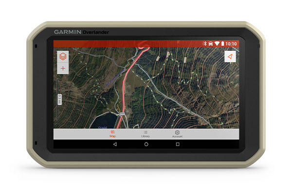
GARMIN EXPLORE

Use the Garmin Explore app to download additional maps — such as satellite imagery and USGS quad sheets on 64 GB of internal storage — and sync all your data between devices. Easily import and export GPX files to Garmin Explore — even if offline.
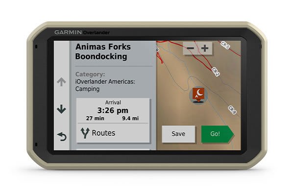
FIND CAMPSITES

Overlander is preloaded with iOverlander POIs and Ultimate Public Campgrounds, so you don’t need a cell signal to route to the best-established, wild and dispersed campsites.

FIND BOUNDARIES

Overlander features topographic maps, including public land boundaries, 4×4 roads, forest service roads, waterways, trails and other land use data.
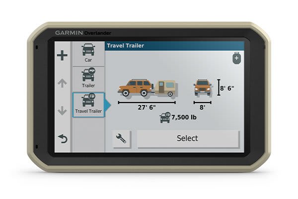
KNOW YOUR VEHICLE

Customize street navigation for the size and weight of your overlanding vehicle, plus get alerts for upcoming bridge heights, weight limits, sharp curves, steep grades and more.

MULTI-GNSS SUPPORT

GPS, GLONASS and Galileo support helps track in more challenging environments than GPS alone.
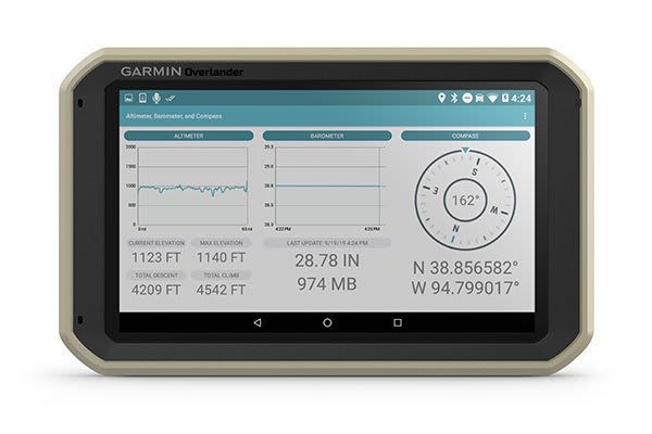
NAVIGATION TOOLS

All of your overlanding equipment — such as a built-in compass, altimeter and barometer — is now in one device.

The right tools for the roughest roads.
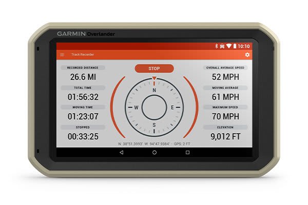
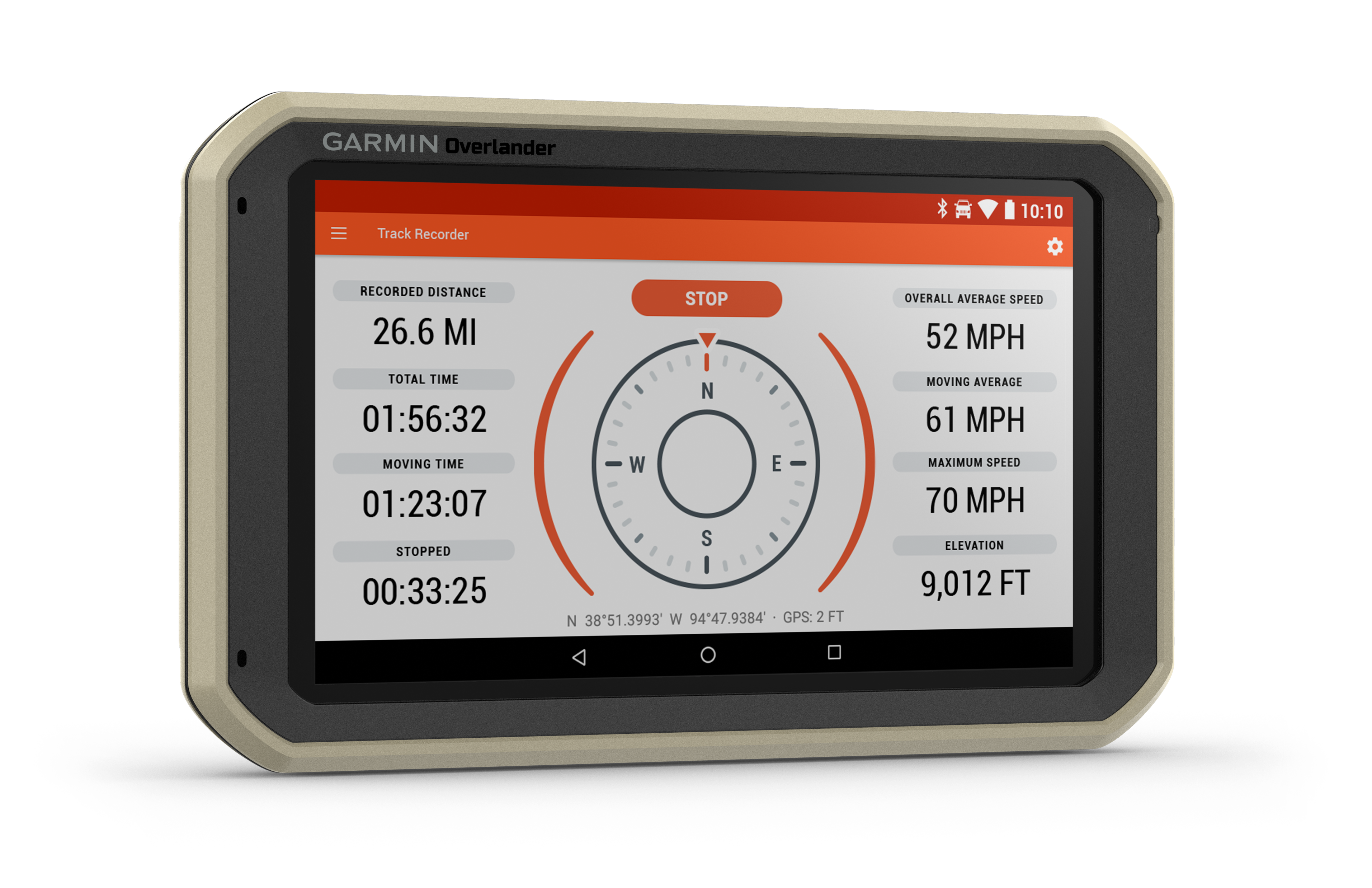
TRACK RECORDER

Record your tracks, and save them to your Garmin Explore account so you can review them later on any device or share them with friends.
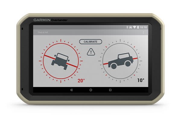
PITCH AND ROLL

Overlander comes with integrated pitch and roll angles to help you and your vehicle navigate difficult terrain.
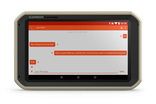
INREACH® COMPATIBLE

Pair your Overlander navigator with the inReach satellite communicators2 (sold separately) for two-way text messaging, interactive SOS and weather forecasts.

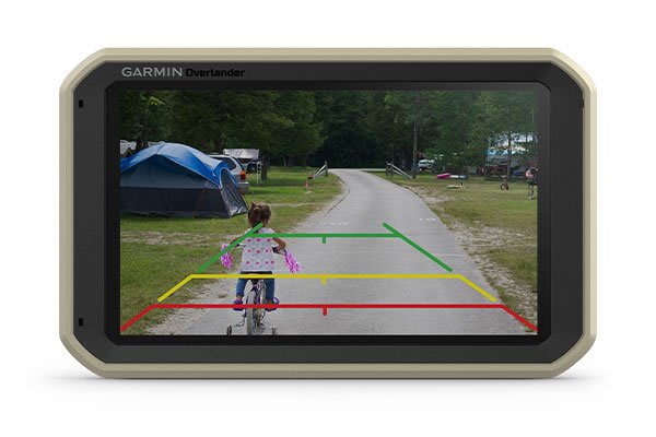
BACKUP CAMERA COMPATIBLE

Pair your Overlander with up to 4 of our BC™ 35 wireless backup cameras (sold separately) so you can see what’s behind you.

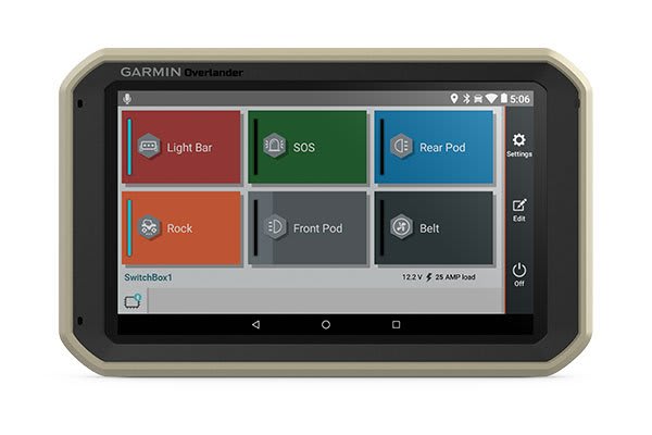
CONTROL YOUR ACCESSORIES

Pair Overlander with the Garmin PowerSwitch digital switch box (sold separately) to enable on-screen control of your rig’s 12-volt accessories including light bars, rock lights, SOS and more.

Garmin proudly supports Tread Lightly! and responsible outdoor recreation

Requires an active connection enabled with Wi-Fi® wireless technology
Active satellite subscription required for inReach device
Wi-Fi is a registered trademark of the Wi-Fi Alliance.

Physical & Performance

Display Size 6.0″ W x 3.5″ H (15.2 x 8.9 cm); 6.95″ (17.7 cm)
Battery type rechargeable lithium-ion
Display resolution 1024 x 600 pixels
GPS Yes
Dimension 7.84″ W x 4.79″ H x 0.93″ D (19.9 x 12.2 x 2.4 cm)
Waterproof No
Weight 15.4 oz (437 g)
Display Type multi-touch, glass, WSVGA color TFT with white backlight
Battery life up to 3 hours

Maps & Navigation

Preloaded street maps Yes

Features

Ultimate Public Campgrounds Yes
Clarity ™ HDR No
Wi-Fi® map and software updates Yes
Sunlight readable and weather resistant No
Round trip routing No
Includes automotive mount No
Speed limit changes Yes
Speed limit indicator (displays speed limit for most major roads in the U.S. and Europe) Yes
IFTA fuel logging capability No
Magnetic Mount Yes
Access to live services via app (traffic, weather, etc.) No
Rider alert warnings for sharp curves, state helmet laws, speed cameras and more No
Preloaded topographical maps Yes
Service History Log No
Track recorder (breadcrumbs) Yes
Simple truck profile No
VIRB® control No
LiveTrack via app No
RV Parks & Services directory Yes
GLONASS Yes
Downloadable Satellite Imagery Yes (U.S. only)
Voice-activated navigation (operate device with spoken commands) Yes
TripAdvisor® Traveler Ratings Yes
Headphone jack/audio line-out No
Control music and media from smartphone or MP3 player No
Specialized routing for the size and weight of your vehicle yes
Route shaping through preferred cities/streets Yes
Trucking points of interest No
Built-in Spotify® & Pandora® music players No
Removable battery No
Garmin Adventurous Routing™ No
Wireless ANT+® technology No
Glove-friendly touchscreen No
Pair with compatible inReach® devices Yes
Smart notifications via app No
Elevation profile No
Custom map support No
Sunrise/sunset times – Trucking No
3D Terrain Yes
Truck & Trailer Services directory No
TOPO map support No
Dust rating IP5X
Mile marker info – Trucking No
Millions of Foursquare® points of interest Yes
Includes map updates Yes
Barometric altimeter Yes
Dual-orientation display No
Planned & dynamic fuel stops No
Includes traffic No (optional traffic cable accessory)
GPS speed and location info in video No
Built-in dash camera with automatic incident detection No
Pitch and Roll gauges Yes
Sunrise/sunset times – RV Yes
Driver alerts for sharp curves, school zones, red light and speed camera warnings and more Yes
Mile marker info – RV No
Camera-assisted features for forward collision warnings, lane departure warnings and “Go” alert. No
Downloadable USGS Quad Sheets Yes
State & country border notices – Trucking No
Road elevations yes
Motorcycle or powersports specific points of interest for cycle repair services, dealers and more No
State border notices – RV Yes
Helmet law notifications No
Drop rating MIL-STD-810
Compass Yes
Track support No
Compatible with Garmin Explore™ app Yes
Galileo Yes
Truck-specific speed limits No
Internal storage 64 GB
Incident Detection (G-Sensor) No
HOS violation warnings No
1″ ball adapter with AMPS plate Yes
Data cards microSD™ card (not included)
3-D buildings and terrain No
Backup camera compatible yes (BC™ 35)
Garmin Real Directions™ landmark guidance Yes
Lane assist with junction view (displays junction signs) Yes
iOverlander™ points of interest Yes
  • Overlander
  • Vehicle suction cup with powered magnetic mount
  • 1″ ball adapter with AMPS plate
  • Vehicle power cable
  • USB cable
  • Documentation
Weight 2.21 lbs

Reviews

There are no reviews yet.

Be the first to review “Overlander®”

Your email address will not be published. Required fields are marked *


The reCAPTCHA verification period has expired. Please reload the page.